Look out! Space junk! Where’s Sandra Bullock???
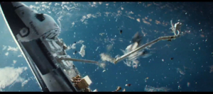 If you saw the 2013 Sandra Bullock-George Clooney science-fiction movie Gravity, then you know about the silent but deadly damage that even a small object can do if it hits something like the Hubble telescope, a satellite, or even the International Space Station as it hurtles through space. If you didn’t see Gravity, a non-spoiler, one-word summary would be “disaster.” Given the thousands of satellites and pieces of man-made debris circling our planet, plus new, emerging threats from potentially hostile satellites, you don’t need to be a rocket scientist to know that it’s important to keep track of what’s around you up there.
It all starts with the basic physics of motion and managing the tens of thousands of data points associated with those objects, says Paul Graziani, CEO and cofounder of Analytical Graphics. The Exton, Pennsylvania-based software company develops four-dimensional software that analyzes and visualizes objects based on their physical location and their time and relative position to each other or to other known locations. AGI has leveraged its software models to build the ComSpOC – its Commercial Space Operations Center. ComSpOC is the first and only commercial Space Situational Awareness center, and since 2014 it has helped space agencies and satellite operators keep track of space objects, including satellites and spacecraft.
ComSpOC uses data from sensors that AGI owns around the globe, plus data from other organizations, to track objects in space. These sensors include optical telescopes, radar systems, and passive rf (radio frequency) sensors. “A telescope gathers reflections of sunlight that come off of objects in space,” Graziani says. “And a radar broadcasts radio signals that reflect off of those objects and then times how long it takes for those signals to get back to the antenna.”
The combination of these measurements helps pinpoint the position of each object. The optical measurements of the telescopes provide directional accuracy, while the time measurements of the radar systems provide the distance of that object from the surface of the Earth. Passive rf sensors, meanwhile, use communications antennas that receive the broadcast information from operational satellites to measure satellite position and velocity.
Read more in my story for Forbes, “How Satellites Avoid Attacks And Space Junk While Circling The Earth.”

