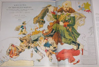
"Angling in Troubled Waters" is a wonderful map
 One of the best historical references is Colin McEvedy’s “Atlas of Recent History (Europe since 1815).” The current 2003 edition has a boring cover, but my 1982 first edition edition has a cover showing part of a fascinating historical map.
The map is called “Angling in Troubled Waters,” drawn in 1899 by Fred W. Rose. It’s referred to as “A Serio-Comic Map of Europe.” It’s absolutely delightful. Not only is it beautifully drawn, but the countries are depicted as characters with references to what was going on in Europe at the end of the 19th century.
For many years, I’ve been searching for quality print, suitable for hanging. No luck so far. However, I found a nice graphic of the entire “Angling in Trouble Waters” on the Catholicgauze blog. The link brings you to a larger version. Enjoy.
